

Kloua archaeological sites are among the most important and oldest sites in northwest Saudi Arabia. They are located at the end of the Al-Tubayq mountain range, on the western banks of Wadi Al-Sarhan. Strategically located between the mountain range and the northern sand dunes, Kloua lies on the route connecting northern Arabia and the southern Levant. These sites feature multiple periods of settlement, from prehistoric times through the Bronze and Iron Ages, continuing into the rise of the ancient Arab kingdoms and the Islamic era. Kloua contains Christian relics from pre-Islamic Arab Christians, including a religious site linked to a monastery (church) and monks’ cells.
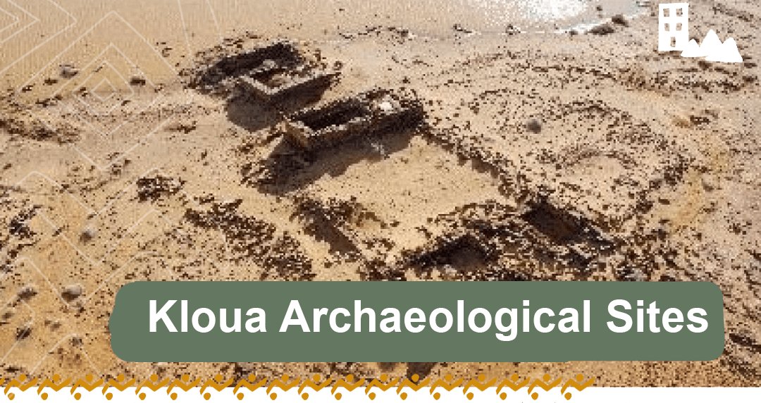
The area is rich in various rock art forms and ancient inscriptions, such as Thamudic, Safaitic, Aramaic, Nabataean and early Islamic inscriptions. Notably, one inscription confirms that the concept of protected areas in King Salman Reserve dates back over 1,500 years.
Manwah Village is located 30 miles east of Al-Qurayyat. It is a heritage village for the Al-Saher family, among others, which is surrounded by rocky heights, mountains, and deep water depressions. Archaeological surveys documented the spread of mud buildings, their areas, dimensions, and architectural styles. The village consists of scattered architectural units with similar architectural styles and interior layouts. The buildings are large with central courtyards and high walls. They were constructed from mud and basalt rocks, using palm fronds and local wood, and have windows and doors of various shapes. The village is situated in a depression surrounded by mountains, and many stone cairn tombs from prehistoric periods have been discovered around it.
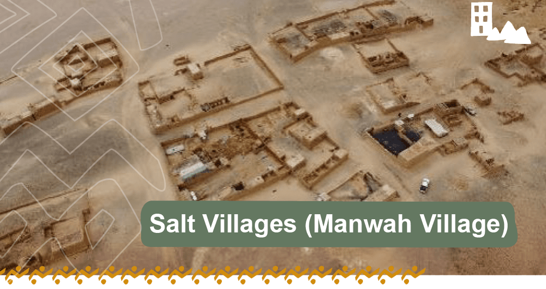
The survey documented 24 units or houses, the number of units per house varying with some almost completely destroyed and others only slightly affected. Some buildings have windows and doors with distinctive geometric decorations.
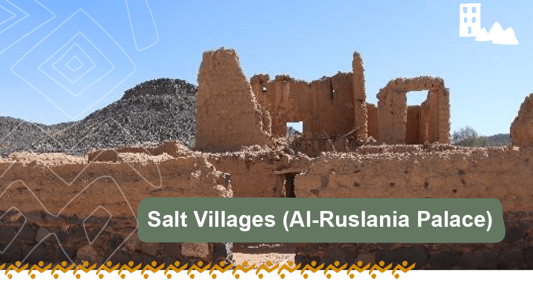
Known as Kaf Palace, it integrates with its cultural and natural surroundings. This palace, referred to as “Ibn Shaalan Palace,” is located on a medium-height hill in the northeastern part of Kaf heritage village, under the slope of Al-Saeedi Mountain in the Salt Villages area, in the northern part of Wadi Al-Sarhan. It was built in 1338 AH/1919 A.C. by Nawaf Al-Shaalan, the eldest son of Sheikh Nuri Al-Shaalan, the chief of the Ruwala tribe. The palace was constructed to serve as the administrative center for Al-Qurayyat and Wadi Al-Sarhan. However, after 2-3 years, King Abdulaziz bin Saud extended his rule to include the Salt Villages area.
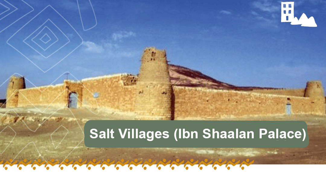
As a result, Kaf Palace became the administrative center for the region until 1357 A.H./1938 A.C., when the regional emirate was moved to Nabk, now known as Al-Qurayyat city. In 1421 A.H./1992 A.C., most villages in the Al-Qurayyat area (such as Al-Haditha, Ithra, Manwah, Qarqar, Ain Al-Hawas, and Al-Issawiyah) were annexed to the Emirate of Al-Jouf region.
Al-Haditha Emirate Palace is one of the most important historical landmarks built during the reign of King Abdulaziz bin Abdulrahman Al Saud (may Allah have mercy upon him). It is a significant site representing the consolidation of the Saudi Third State. Located west of Al-Haditha village, a border village with the Hashemite Kingdom of Jordan, it serves as the northern agateway to Saudi Arabia. The palace is historically and culturally significant as one of the key symbols in the northern region.
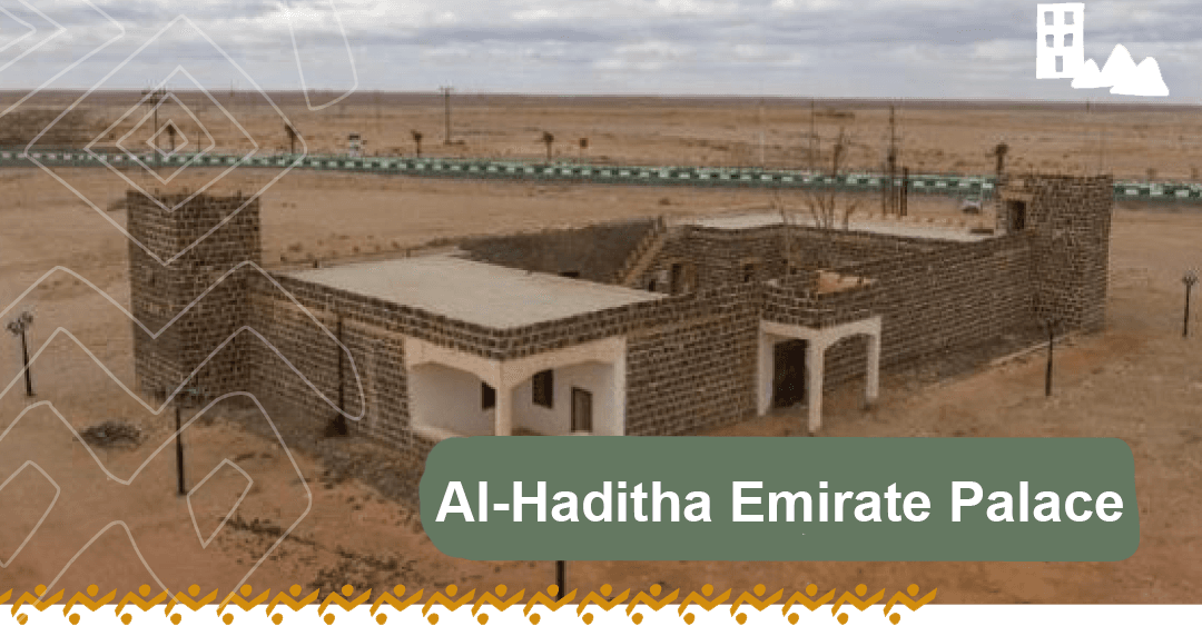
It is situated east of the old Al-Haditha village, now a modern center in the Al-Jouf region. The village has expanded far from the palace, which occupies a natural hill on the elevated volcanic Harrat near the international road.
Mughayra Al-Tubayq heritage village is one of the most important heritage villages in the Tabuk region of northern Saudi Arabia. Its significance stems from its administrative, political, and economic importance as the Saudi-Shami gateway. It is located on the Shami pilgrimage route that starts from Bosra, then Damascus, followed by Azraq in Jordan, then Al-Qurayyat, Mughayra Al-Tubayq, Fajr, Tayma, Jafr Aniza, Khaybar, Medina, and finally to Mecca. This village was established in the early Saudi era and was abandoned a few decades later.
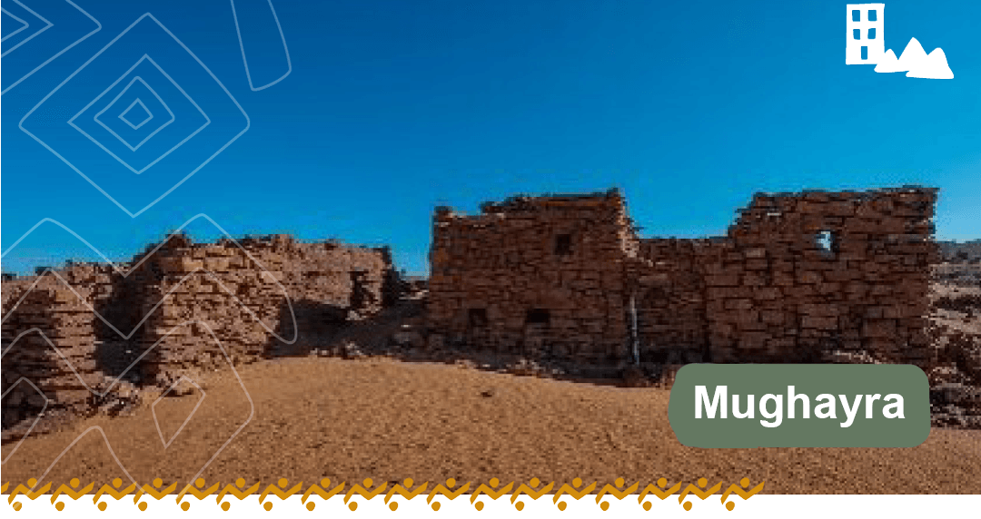
Mughayra served as one of the administrative centers affiliated with the Al-Qurayyat region during the reign of King Abdulaziz bin Abdul Rahman Al Saud, when the administrative capital of Al-Qurayyat was the heritage village of Kaf.
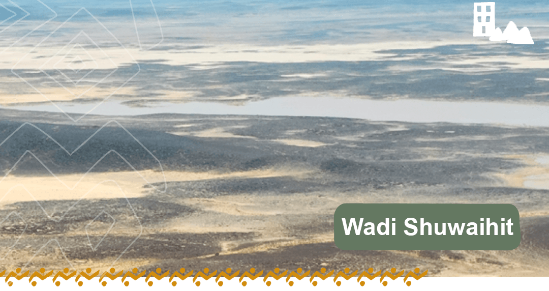
Wadi Shuwaihit is one of the important landmarks within the King Salman bin Abdulaziz Royal Reserve. It is home to numerous Stone Age structures and significant archaeological sites. Among the most important is the cultural heritage dating back to prehistoric times, specifically the Oldowan culture, which dates back 1.3 million years. The artifacts of Wadi Shuwaihit are diverse, ranging from natural to cultural heritage across the ages, and include various components such as ancient lakeshores, valleys, and hills. The area is rich in different stone structures, rock art, and ancient Arabic inscriptions.
Near the Reserve lies the heritage village of Al-Shuwaihitiyah and the historic Ibn Bulehid Palace (Emirate Palace of Al-Shuwaihitiyah), both built during the early Saudi era under King Abdulaziz bin Abdul Rahman Al Faisal (may Allah have mercy upon him), the founder of the third Saudi state.
Ethra heritage village is one of the villages that gained importance since the Nabataean era in the Al-Qurayyat region. It is rich in archaeological sites with ancient architectural structures and natural resources, including water springs and agricultural oases. Ethra is located about 35 km east of Al-Qurayyat and 12 km from the heritage village of Kaf. Due to its historical significance, it has been mentioned in many sources.
Archaeological surveys in the village revealed many heritage sites, including eight mud houses, a stone-built mosque, and two cemeteries.
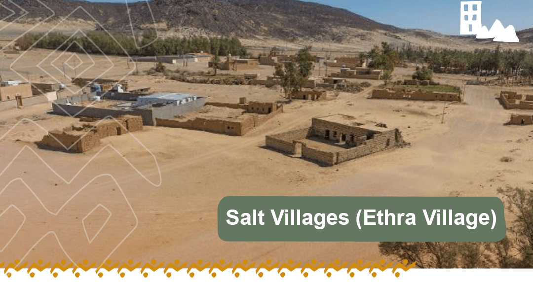
The surveys and measurements of the buildings showed that the village consists of widely spread mud buildings of varying sizes, from large spacious houses to smaller structures. The service facilities within each house varied, including rooms and halls, as well as the mosque. The buildings were generally constructed from mud bricks with stones and showed signs of natural wear, with many needing maintenance and restoration.
One of the distinctive heritage palaces near the Al-Wasi`ah well, located within a farm in the eastern part of the Ethra oasis, at the foot of Mount Radwa, about 1 km from the heritage village of Kaf. The Ethra area is characterized by diverse topography and rich natural scenery surrounding the palace. The palace is a mud building situated in a sand depression, surrounded by agricultural oases. It consists of two rows of rooms enclosed by walls that have collapsed and undergone some restoration and updating. Near the rooms, there are some wells.
The general shape of the palace resembles other heritage palaces in the area, built from basalt stones and mud bricks. The palace features high rooms with multiple windows and doors. Fieldwork focused on documenting the palace and its architectural facilities, assessing the damage it has suffered, and its importance as a heritage building needing restoration and maintenance to become a tourist attraction.
One of the most notable sites associated with Hatem Al-Tai is Tuwarin, which today contains many heritage houses known as Hatem Al-Tai’s houses. It is one of the prominent heritage landmarks in the Hail region.
Tuwarin is named after a valley that extends in the middle of the Aja mountain range, about 8 km away. The valley widens at the beginning of its tributaries and narrows at its end before flowing into the northern desert.
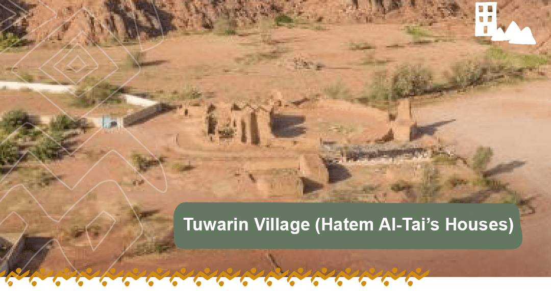
The site of Hatem Al-Tai’s houses is surrounded by mountains on three sides: the southern side (tributaries of Wadi Tuwarin), the eastern, and the western sides. The site occupies a strategic location among the smooth granite mountains, forming small oases at the base of these mountains, making it fertile land.
Located about 40 km east of Al-Qurayyat, Al-Madhin Nabataean Palace is one of the most important architectural landmarks in the northern region. It is a unique architectural monument due to its size, building materials, and location. Some previous studies date it to the Nabataean era, while others attribute its origin to the Byzantine period, and it continued to be used in later periods.
Archaeological work at the palace began with a survey around its exterior, identifying the wall and its contents, and assessing its current condition.
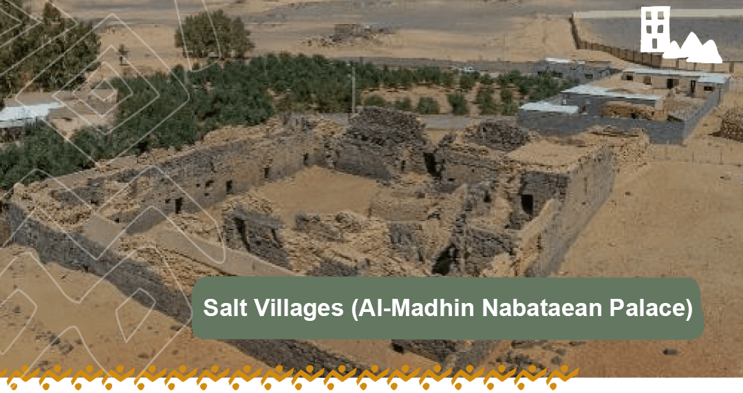
The architectural units of the palace were documented and measured. The palace was built from hard basalt stones, cut in a remarkable geometric manner, and constructed over two floors. It contains 19 architectural units distributed in four directions, connected by corridors and a large wall with two gates.
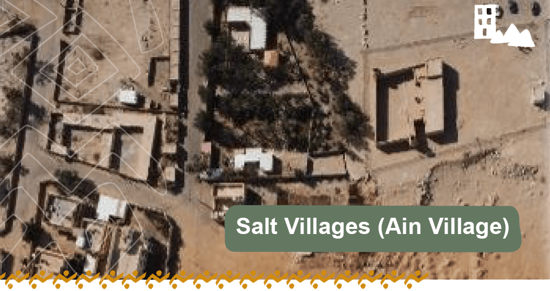
The heritage village of Kaf is one of the most important and prominent villages in the Salt Villages. It serves as the main center and the administrative and political capital of the Al-Qurayyat region, encompassing many elements typically found in Islamic cities, such as the palace, market, and government headquarters, surrounded by neighboring villages. Kaf was known as the Salt Pan of Kaf, referring to the area surrounding it, covered by a salt flat from which salt was extracted. Thus, Kaf village represents a central and primary hub for the Salt Villages. Kaf is located in Wadi Al-Sirhan on the old trade route passing through northern Arabia.
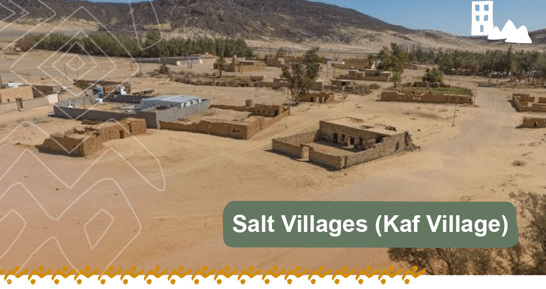
Evidence of its continuous settlement includes the fortress in the northern part, used to protect Kaf village and monitor trade caravans in the past. Kaf village is located east of Al-Qurayyat city today, about 18 km away, and was the capital and main center of the Al-Qurayyat region before the capital was moved to Al-Qurayyat.
Ain Al-Hawas village is located about 33 km northeast of Al-Qurayyat and about 3 km east of the heritage village of Manwah. It is situated in an area abundant with water springs, including the famous Ain Al-Hawas and Ain Al-Daham.
Our fieldwork in the area revealed many archaeological sites, documenting the contents of the heritage village and conducting a comprehensive archaeological survey around the village, which uncovered many sites characterized by large basalt rock cairns and stone enclosures (ibex traps) dating back to prehistoric periods.
Field measurements of the houses revealed that the village consists of 13 mud-brick houses surrounded by farms, with many architectural units and spacious courtyards.
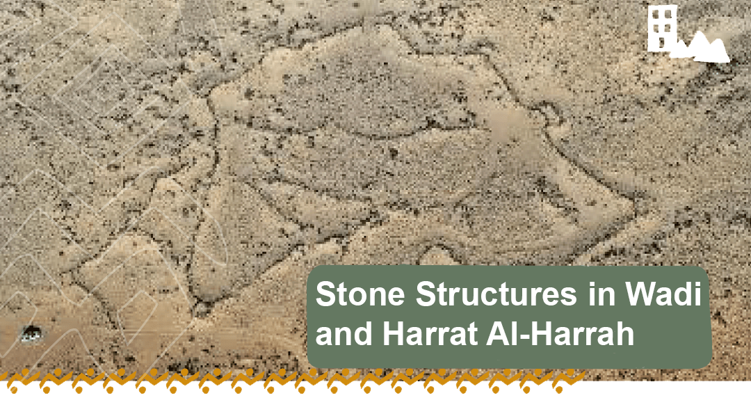
The King Salman bin Abdulaziz Royal Reserve includes significant archaeological and geological features across Wadi Al-Sirhan and Harrat Al-Harrah. Key locations within Wadi Al-Sirhan, such as Al-Qa’idat, Al-Jufairat, and Samra Al-Washwash, feature various stone structures, including ancient traps, tailed tombs, and stone circles. These structures served multiple purposes, including hunting, burial, and daily activities like agriculture and grazing, reflecting the area’s long history of human settlement and use.
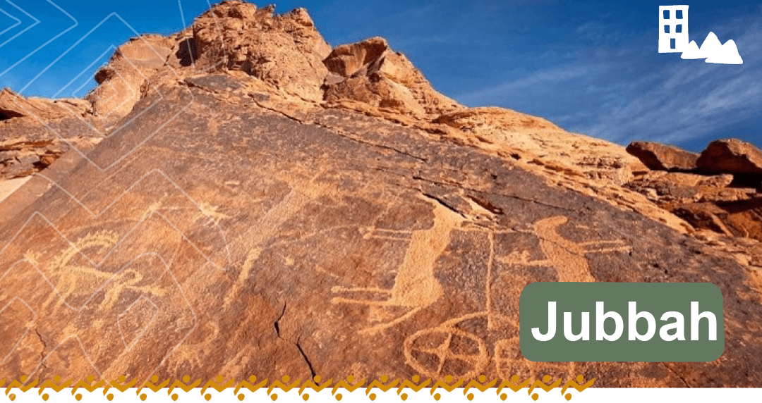
Jubbah, located northwest of Hail, is a remarkable oasis near Mount Umm Sinman. It is famous for its prehistoric significance, with some of the oldest rock art and Thamudic inscriptions found in the region.
Jubbah is one of the Saudi Arabian sites listed on the UNESCO World Heritage List, alongside other rock art and inscription sites in the Hail region, such as Shuwaymis, Rat, and Manjur.
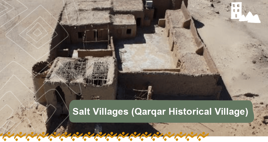
Qarqar Historical Village is famous for its association with the Battle of Qarqar in 853 BC, one of the earliest references to “Arabs” in historical texts. The battle involved an alliance of Arab kingdoms fighting the Assyrian Empire. Located southeast of Kaf heritage village, about 35 km from Al-Qurayyat, Qarqar lies in a dramatic landscape of deep valleys and volcanic mountains, near Manwah and Ain Al-Hawas. Its strategic location in the region further enhances its historical significance.